Saying hello is awkward. Saying goodbye is hard. Waking up to my final morning in Montana was hard, but a quick pack, and multiple goodbye’s later, and I was on my 9 hour speed run for the border: North Dakota. Sleeping in a rest stop, and watching the sun set one last time in Montana, the colors again dazzled me.
----
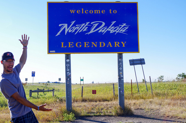
As I continue to wake up in random places, people always give me this strange look as I crawl out of my car. Almost shocked and taken aback, they don’t quite process that they’re seeing someone who actually lives in their car. It’s almost comical, and I wish I could get incognito video for a fun montage. I wandered into the visitor’s center not too far and found what my suspicions had previously told me: there’s basically nothing to do here. With attractions such as: a giant buffalo, a giant cow, giant metal statues on the side of the road, and Fargo, I knew this week was going to be dull at best.

Thankfully there was one small piece of salvation, Theodore Roosevelt National Park. A national park barely over 100 square miles, and split into two units, north and south. It is surrounded by the Missouri National Grassland, which is about as exciting as it sounds. The park entrance it home to a small town with a single gas station that has pumps from the 50’s, and not even a stop light.
Though I had some hesitations about another badlands experience, a quick glance at the map showed a bit more than just 2 hiking trails, and a 10 mile look grabbed my attention. Chatting up a ranger, about solo hiking and rattle snakes, he said I would be fine. The trail would be well marked.
He lied.
The trail consisted of linking up Jones Creek to Talkington, and swinging back up through the Paddock Creek Trail. Simple enough, stay right at all junctions, hit the road for a hot minute, and shoot back up the creek. The first half went smooth, as planned. The trail markers, though mostly white plaques from the buffalo using them as scratching posts, were enough to signal when to keep right. I made it to the road with ease, and proceeded to get completely lost.
The trail maker from the road was sketchy at best, and as I had seen from before, the trail would often split for no good reason, only one of the paths being the right one, and that path was never the one I picked. Thankfully they had the same policy as the SD Badlands: go anywhere, just don’t die. Wandering to the top of a few hills, I found a trail going in the general direction of where I wanted to go. Guided by the terrible park map, my compass, and a fear of any kind of rattling sound, I slowly started bush-whacking through the badlands.

The sky was cloudless, a beautiful gradient of blue from the sun to the horizon. With much more lush green filling the area, and vibrant reds filling the striated rock, I have to say I much preferred this Badlands to the official one. Much smaller in scale, it seemed to hold more elevation gain, beauty, and vividness than the previous one.
Finally finding a trail marker, I made haste out of there and back to my car. Tired, exhausted, and fried, I drove the loop the cool off and relax before heading out. The Enchanted Highway my next stop since it was on the way to Bismarck, the capital and my hopeful home for the evening. The Enchanted Highway is nothing more than a handful of huge (50+ feet high) sculptures on the side of the road. Though nothing too exciting, it was something even my NatGeo Road Atlas had, so I figured it was at least worth a look.

As the sun was setting I gathered the final photos, and made off for the long haul to Bismarck, destination: Wally World. The darkened sky illuminated by the full moon as I cruised past endless farms of various crops, and countless cows. With a sore body from the long hike and drive, I waddled into the bright blue warehouse to clean up, and back to my car for much needed rest.